• XML

    isc pubmed crossref medra doaj doaj
  • List of Articles


      • Open Access Article

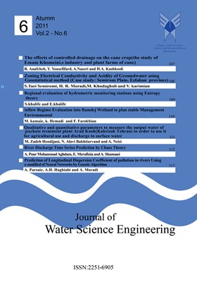
        1 - The Effects of Controlled Drainage on the Cane Crops: The study of Emam Khomeini’s Industry and Plant Farms of cane
        رحیم عنافچه یدالله یوسفی فرد عبدعلی ناصری حیدرعلی کشکولی
        Holding up the phreatic surface near by the plant root zone to effective use of water and provide themoisture on the root zone is a usual method, which uses for several decades by researchers. In thisstudy, we investigate the possibility of controlled drainage method in More
        Holding up the phreatic surface near by the plant root zone to effective use of water and provide themoisture on the root zone is a usual method, which uses for several decades by researchers. In thisstudy, we investigate the possibility of controlled drainage method in dry and half-dryzone (i.e., theclimate of the center and south of the Khuzestan state) on thecane plant. The results showedthat thesalinity of free care soil at the layer (0-30)cm in size 1.3 dz rather than the same layer at the controlledcare had increased. The changes of salinity on the other layers for two cares arelow. In order to wateruse, the test care use 38percent lower than the free care and the efficiency of water in test care is41.3percent more than the free care. In order to water period, the test care was 33 percent lower thanthe free care. According to input salt, the test care is lower than the free care, equal to 36percent.According to output salt of the drainages, the test care was lower than the free care, equal to53percent. The crop quantity performance of the test care was more than the free care in rate of8.66percent;on the crop,quality performance of the test care on the rate of syrup weight for caneweight was (EX) 15.9percent. On the rate of exist sugar in syrup (POL) 6.01 percent, and on the rateof solvable solid elements in syrup (Brix) 5.24percent, and on the level of syrup candor or the rate ofpure syrup, has 0.8percent more than the free care. Manuscript profile
      • Open Access Article

        2 - Zoning Electrical Conductivity and Acidity of Groundwater through Using Geo-statistical Method: A Case Study in Semirom Plain, Esfahan Province
        سیاوش طائی سمیرمی حمیدرضا مرادی مرتضی خداقلی وحید کریمیان
        The groundwater quality research is one of the important and its pollution control was included insome research literatures. Ground water quality has spatial and temporal variation so classical statisticscould not account these variations at the regional scale researche More
        The groundwater quality research is one of the important and its pollution control was included insome research literatures. Ground water quality has spatial and temporal variation so classical statisticscould not account these variations at the regional scale researches. This study usedgeo-statisticalmethodsto optimize an interpolation method in order to estimate the spatial distribution of pH andelectrical conductivity in ground water. The geo-statistical methods which used in this procedure,includedkriging, ordinary kriging, simple kriging, disjunctive kriging, inverse distance weighting andradial. Cross validation was used to evaluate fault detection, root mean square error for statisticalcomparisons,and the geo-statistical analysis was performed in ArcGIS9x software environment. Thecase study was Semirom plain, Esfahan and historical data was collected from 386 springs in yearsfrom 2006 to 2007.The resultsof model validations showed that the variogram spherical model has thebest fit to the spatial data structure of the electrical conductivity and pH. The analysis of RMSE andMAE showed that inverse distance method (with raised to the power of one); RMSE = 0.065; MAE=0.041) and radial function (with RMSE = 3.57; MAE=2.27) were more statistically accurate or havelower RMSE and MAE in comparison to the other methods. Both of these methods have optimumspatial distribution of the pH and electrical conductivity of ground water inSemirom plain. Finally,spatial distributions maps of pH and electrical conductivity was created using ArcGIS9.x (orgeographical information systems). The resultsof maps showed reduction of both variables from theeast to west, in Semirom plain. Manuscript profile
      • Open Access Article

        3 - Regional Evaluation of Hydrometric Monitoring Stations through Using Entropy Theory
        سمیه خلیفه ابراهیم خلیفه
        Proper design and operation of monitoring systems for water resources management is one of themost important issues of water quality and quantity and accuracy and adequacy of data. The properevaluation of these data has a determining role in the correctand consistent de More
        Proper design and operation of monitoring systems for water resources management is one of themost important issues of water quality and quantity and accuracy and adequacy of data. The properevaluation of these data has a determining role in the correctand consistent decisions in the areacovered by the system. Therefore, determining proper distribution and number of monitoringnetwork stations and evaluation of theadequacy of existing network stations are needed to eliminateunnecessary stations and as a result decreasing costs of data productionthat are importantchallenges in the future. In this study, a new approach, based on this theoryof regional value ofhydrometric stations in Bakhtegan- Maharlu watershed has been investigated. In this case, usingdiscrete entropy theory, existing limitations in theprevious studies were removed and consideringthe indices of total information sent by the station S(i), total information received by the stationR(i) and total net information by the station N(i), the monitoring network has been assessed. Theresults of sensitivity analysis showed that values of entropy indices are sensitive to variation ofdata-classification interval. The calculated values of R(i) and S(i)are equivalent completely andeach station received as much information as it sent to other stations. In addition, with regard toacceptable results by Storeajse relation, using this equation to determine the appropriate number ofclasses is recommended. The obtained results showed that 4 out of 14 hydrometric Stations are incritical conditions and it is recommendedthat they should be removed from the network. Manuscript profile
      • Open Access Article

        4 - Inflow Regime Evaluation into Bamdej Wetland to Plan Stable Environmental Management
        معصومه کمالی کاظم حمادی فروزان فرخیان
        In the recent years,theprojects developed the studies onwater resources and agriculture, developmentof human societies, the phenomenon of climate change and drought greatest environmental impact,socio-economic and industry in developing and even under developing countri More
        In the recent years,theprojects developed the studies onwater resources and agriculture, developmentof human societies, the phenomenon of climate change and drought greatest environmental impact,socio-economic and industry in developing and even under developing countries. Results of theseissues showed the effects of mortality and immigration, human and animal species, environmentaldegradation, the lack of food resources, energy, water and other natural resources degradation.Therefore,in many scientific circles, the proper use of natural resources, land management, ecosystemconservation and agricultural activities in order to reduce the damaging effects of environmentalstresses is controlled. Bamdej wetland with an area of 4000 hectares located in the South Westprovince, which is fed by the river Shavoor seems to depend on the wetlands for sustainableenvironmental management and environmental factors, including factors involved in the developmentof the drainage basin whichis adjacent to. This research studied thewetlands along the river Shavoorfield. Itaimed to assess the quality and quantity of water flow and provide a suitable model Bamdejpond water to improve environmental management of thewetlands. Preliminary analysis of the annualinflow to the wetland appeared to set two separate samples is formed further data on the original seriesand two series of samples have been analyzed separately. Statistical analysis showed the differencebetween the two series of data through SPSS statistical software. Consequently, a series of annual flowwas also taken into consideration. For water quality parameters such as EC, TDS, total cations, totalanions and pH,two distinct consistent flow regime and a series of extractionwere analyzed. The resultsshowed that there were statistically significant in both series. Results gave a model of environmentalmanagement with emphasis on the quality and quantity of the inflow to the wetland ponds. Theseparameters can be programmed to yield equivalent to 600 million cubic meters, 3 million cubic metersof potable needs, industry needs 7 million cubic meters, 25 million cubic meters for aquaculture,agriculture require 500 million cubic meters, and 140 million cubic meters environment. Follow thepattern of the upstream needs such as agriculture, environmental needs and meet wetland ponds willstabilize the system.Keywords: Hydrological Manuscript profile
      • Open Access Article

        5 - Qualitative and Quantitative Parameters to Measure the Output Water of Leachate Treatment Plant Arad Kooh(Kahrizak Tehran) in order to Use it for Agricultural Use and Discharge to Surface Water
        مریم زاده هندیجانی سید نادعلی علوی بختیاروند عبدالکاظم نیسی
        In this study, the use of backwash, extracted from city waste from Tehran's Kahrizakareawasinvestigated in agricultural applications as well as in eco system applications. The purpose of thisresearch was to definethe quality of qualitative and quantitative parameters to More
        In this study, the use of backwash, extracted from city waste from Tehran's Kahrizakareawasinvestigated in agricultural applications as well as in eco system applications. The purpose of thisresearch was to definethe quality of qualitative and quantitative parameters to measure the output ofleachate treatment plant Arad Kooh(Kahrizak Tehran) in order to reuse it for agricultural use anddischarge to surface water. This research is based on a standard method 2005,ASTAM 2009/1102/1101& DIN 2008. In all, the resultsindicated that as far as the following seven parameters are concerned, thewaste backwash at Aradkooh meets theIranian eco system standards (those seven parameters being:PH, EC, zinc, phosphate, nitrate <only for dumping into shallow waters>, total coliform level and theopacity level). In addition, as far the following sixparameters are concerned, the said backwash meetsthe standards of the International Health Organization (these six being PH, zinc, TDS, nitrate and totalcoliform). Finally, as far as the following seven parameters are concerned, Aradkooh's backwashmeets the standards of the International Wheat and Groceries Organization (these parameters being:PH, zinc, dissolved solids, ammonia, nitrate and total coliforms). However,the study showed that thelevels of the heavy metals of cadmium and lead are above the stated standards of the following threeorganizations: the Iranian eco System Organization, the International Health Organization and theInternational Wheat and Groceries Organization. The biochemical and chemical oxygen demandparameters have been restricted for irrigation consumption because of they are assumed as pollution.So this backwash is pollutedand it is not useful for irrigation consumption. If we want to use thisbackwash for irrigation consumption, we have to treat it to reduce that mentioned pollution parametersin accordance to the Iranian eco system standards following International Health Organization andInternational Wheat and Groceries Organization. Manuscript profile
      • Open Access Article

        6 - River Discharge Time Series Prediction by Chaos Theory
        احمد پور مقدم ادریس معروفی نیا ابوالفضل شمسایی
        The application of chaos theory in hydrology has been gaining considerable interest in recent years.Based on the chaos theory, the random seemingly series can be attributed to deterministic rules. Thedynamic structures of the seemingly complex processes, such as river f More
        The application of chaos theory in hydrology has been gaining considerable interest in recent years.Based on the chaos theory, the random seemingly series can be attributed to deterministic rules. Thedynamic structures of the seemingly complex processes, such as river flow variations, might be betterunderstood using nonlinear deterministic chaotic models than the stochastic ones. In this paper,chaotic behavior of the daily river discharge time series from the BarandozChay, fromSeptember,1983to August, 2009 is investigated. To reconstruct phase space, the time delay and embedding dimensionare needed and for this purpose, Average Mutual Information (AMI) and algorithm of False NearestNeighbors (FNN) wereused. Correlation Dimension method was applied for investigating chaoticbehavior of daily discharge. The delay time and optimum-embedding dimension were obtained 66 and4 respectively. The low amount of correlation dimension (d=3.1) represents the chaotic behavior ofBarandoz river discharge time series. Manuscript profile
      • Open Access Article

        7 - Prediction of Longitudinal Dispersion Coefficient of Pollution in Rivers Using a Modified of Neural Networksby Genetic Algorithm
        عباس پارسایی امیر حمزه حقی آبی امیر مرادی نژاد
        Reductionof Surface water quality and pollution in the environment is majorproblems. This issuewill become more important because the rivers are as a source for supplied for drinking water forpeople, industrial and agriculture. Prediction and modeling of hydraulic pheno More
        Reductionof Surface water quality and pollution in the environment is majorproblems. This issuewill become more important because the rivers are as a source for supplied for drinking water forpeople, industrial and agriculture. Prediction and modeling of hydraulic phenomenon is one of themost importantactivities of Hydraulic Engineering. Neural network is one of the most usefulmethods of data processing which capable of modeling the complex relationships between inputand output. In this study, for prediction of the dispersion coefficient of pollution in rivers andthedevelopment of neural network (ANN) and empirical formulas wasstudied. Best accuracy ofthem is related to the Tavakollizadeh and Kashefipur, formula which its error index R 2 􀀠 0.77 .To increase in the perdition of the dispersion coefficient, the multi-layer perceptron (MLP) wasdeveloped. Training process and simulation MLP model was conducted in the Matlabsoftwareenvironment.To increase the performance of the MLP, genetic algorithm for training process isused. The results showed that the MLP are more accurate in comparison with otherempiricalequations.Using genetic algorithms for neural network training the neural networkmodel will further increase its accuracy about the 19 percent. Manuscript profile