• XML

    isc pubmed crossref medra doaj doaj
  • List of Articles


      • Open Access Article

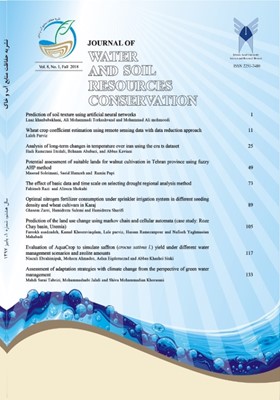
        1 - Prediction of soil texture using artificial neural networks
        علی محمدی ترکاشوند Elnaz Khanbabakhani Mohammad Ali Mahmoodi
        Soil texture is one of the most important soil properties that affect many physico-chemical properties such as water storage, cation exchange capacity (CEC), soil fertility and soil ventilation. Today, artificial intelligence technology such as neural and neuro-fuzzy ne More
        Soil texture is one of the most important soil properties that affect many physico-chemical properties such as water storage, cation exchange capacity (CEC), soil fertility and soil ventilation. Today, artificial intelligence technology such as neural and neuro-fuzzy networks is used to solve problems in modeling systems and processes. For this purpose, 150 soil samples from a depth of 0 - 15 cm of Gavshan Dam watershed in the Kurdistan province were collected. The geographic locations, height and slope percent of every sampling point were recorded. The particle size distribution of samples was measured in the laboratory using hydrometer method. The longitude and latitude, height, slope percent and soil texture particles of training points were introduced to artificial neural networks to estimate soil texture particles by MATLAB software. The accuracy of model was evaluated by scoring, using statistical indicators such as root mean square error (RMSE), the ratio of geometric mean error (GMER) and correlation coefficient (R2). According to the results, the values for estimating sand and clay are approximately the same and for predicting the silt, less than sand and clay, and 37.0, although less error. The accuracy and accuracy of the model show that the neural network does not have any accuracy and accuracy in estimating the percentage of soil texture components and the soil texture mapping. Manuscript profile
      • Open Access Article

        2 - Estimating wheat crop coefficient using remote sensing data and data reduction approach
        Laleh Parviz
        Optimal use of irrigation water requires to the precise irrigation planning and the accurate crop coefficient estimation is the prerequisite of that particularly in the global scale. The aim of research was the comparison of preprocessing approaches of artificial neural More
        Optimal use of irrigation water requires to the precise irrigation planning and the accurate crop coefficient estimation is the prerequisite of that particularly in the global scale. The aim of research was the comparison of preprocessing approaches of artificial neural network: regression and data reduction (principle component analysis and rotation) for crop coefficient estimation using NDVI, RI, TVI, MSAVI, SAVI, mTVI, EVI, MNDVI and TVX for wheat crop coefficient of East Azarbaijan Province. The performance of regression and data reduction approaches indicated the error criteria decreasing of data reduction approach, for example RMSE increasing from rotation to regression and from principle component analysis to regression was 11.8 and 22.7%, respectively. The used approaches of crop coefficient estimation has overestimation as the average increase of crop coefficient in the validation period showed 7.7, 6.13 and 4.6% increasing of crop coefficient from FAO to the regression, principle component and rotation approaches, respectively. Therefore, using the rotation in the data reduction analysis increased the accuracy of estimation. Decreasing of correlation coefficient-39.13% - from MSAVI to NDVI indicated that the improved indices basis on the study area condition increased the performance of crop coefficient estimation using satellite images. Manuscript profile
      • Open Access Article

        3 - Analysis of long-term changes in temperature over iran using the cru ts dataset
        هادی رمضانی Behnam Ababaei Abbas Kaviani
        Study of climate change helps in the management of water resources and agricultural production. Temperature increase is one of the most definite aspects of climate change. Limited number of weather stations and the quality and duration of records of weather variables ar More
        Study of climate change helps in the management of water resources and agricultural production. Temperature increase is one of the most definite aspects of climate change. Limited number of weather stations and the quality and duration of records of weather variables are among the most important limiting factors in climate change studies. Application of gridded regional/global datasets is a promising option to overcome these limitations. In this study, temporal trends in annual, seasonal and monthly averages of daily minimum, mean and maximum temperatures were analysed using the data obtained from the CRU TS 4.01 gridded dataset and the Mann-Kendall (MK) test. The results show that over 1987-2016 (second period), long-term national annual average of daily mean temperature has increased by 0.4-1.2 °C across the country as compared to 1957-1986 (first period). Over the last here decades, temporal trend in annual average daily mean temperature was estimated at 0.39 °C.dec-1 (1.17 °C increase in 30 years). The observed increase in daily minimum temperature (1.23 °C in 30 years) over the second period was larger than the increase observed in daily mean temperature. Analysis of temporal trends in seasonal averages reveals that winter and spring, especially in the west and northwest, experienced the strongest positive trends over the last three decades. The results of this study confirm the occurrence of significant temperature changes in winter, spring and summer, which are important to the country’s agriculture sector. Manuscript profile
      • Open Access Article

        4 - Potential assessment of suitable lands for walnut cultivation in Tehran province using fuzzy AHP method
        Masoud Soleimani Saeid Hamzeh Ramin Papi
        As a highly productive product, walnut plays an important role in the social and economic condition of farmers in various regions across Iran, and there has been a dramatic increase in the area under cultivation of this product in recent years due to its economic return More
        As a highly productive product, walnut plays an important role in the social and economic condition of farmers in various regions across Iran, and there has been a dramatic increase in the area under cultivation of this product in recent years due to its economic return. Walnut trees are highly sensitive to the climate conditions. Therefore, before Cultivation of this product, which requires a relatively high initial investment, it is necessary to take certain measures to identify and assess suitable lands for planting walnut trees. Therefore, this study aims to identify and assess suitable lands for planting walnut in the entire of Tehran province that would result in a desirable production efficiency. For this purpose, this study uses climatic parameters (including temperature, relative humidity, precipitation, and wind speed) from 12 synoptic stations within Tehran Province and 8 stations from adjacent provinces for an 11-year statistical period (from 2004 to 2014), topography, and land use for site selection and zoning of suitable regions for cultivation of Persian walnut. First, raster data layers were generated using all the parameters under study. Then, through a review of literature and expert views on physiological properties and growth requirements of walnut, the desirable and undesirable thresholds for its cultivation were determined. Next, analytic hierarchy process (AHP) and a researcher-made questionnaire were used to calculate the effectiveness and priority of each parameter. Furthermore, a fuzzy membership function was used to normalize the data layers. Finally, the final zoning map was prepared and extracted using fuzzy overlay tools in ArcGIS. According to this map, an area of 243882.9562 hectares, equal to 17.82% of the entire area of Tehran Province proved very suitable for cultivation of Persian walnut. Moreover, the findings indicate that the three parameters of temperature, relative humidity, and aspect have a special significance and effect on the growth of walnut trees.     Manuscript profile
      • Open Access Article

        5 - The effect of basic data and time scale on selecting drought regional analysis method
        Fahimeh Razi Alireza Shokoohi
        One important issue in drought studies is realizing the spatial pattern of drought events in a region through point estimation of the drought characteristics. In the first section of this research, in order to investigate the effect of probability distribution function More
        One important issue in drought studies is realizing the spatial pattern of drought events in a region through point estimation of the drought characteristics. In the first section of this research, in order to investigate the effect of probability distribution function transformation embedded in SPI, on the spatial distribution of drought, regional analysis was carried out using precipitation and SPI data, separately. The case study is the ​​Anzali wetland watershed in the north of Iran. The results in terms of the employed regional analysis method and time scale were different. The results showed that by decreasing the time scales to less than 1 year, while by the SPI index the region was completely homogeneous, the region was divided into different sub-regions using precipitation. The important conclusion drawn from this part of the research was the necessity of zoning the region via precipitation and then analyzing drought in the obtained regions. In the second part of the research, a comparison was made among three zoning methods including; L-moment, hierarchical and non-hierarchical clustering methods using precipitation and SPI, separately. Overall, L-moment was more successful than the other two clustering methods in detecting homogeneous regions in the study area. Finally, it was concluded that reducing events time scales sharpened the difference between the zoning methods; therefore, choosing an appropriate zoning method would be more important in monthly and seasonal time resolutions. Manuscript profile
      • Open Access Article

        6 - Optimal nitrogen fertilizer consumption under sprinkler irrigation system in different seeding density and wheat cultivars in Karaj
        Ghasem Zarei Hamidreza Salemi Hamidreza ُSharifi
        The large area of wheat cultivation in Iran is located in arid and semi-arid regions and due to water shortage in end growing stage, there is competition between wheat and other crops for water allocation. In these conditions, using suitable seeding density and modern i More
        The large area of wheat cultivation in Iran is located in arid and semi-arid regions and due to water shortage in end growing stage, there is competition between wheat and other crops for water allocation. In these conditions, using suitable seeding density and modern irrigation systems for yield increasing is important. Although Nitrogen is the most important element for quantity and quality of wheat, but over using of Nitrogen base fertilizers causes leaching, decreasing fertilizers use efficiency and groundwater contamination. This research was conducted during two years with Split Factorial Design experiment. The treatments of this experiment were: Three fertilizers application methods (conventional fertilizers application with full recommended amount, fertigation method with sprinkler irrigation and full recommended amount, and fertigation method with sprinkler irrigation and 70% nutrition recommended), three wheat variety (Pishtaz, Shiraz, and Bahar) and three plant density (300, 400, and 500 seed in each square meter). In this study the amount of water use, fertilizer requirement in case of fertigation, suitable density and variety of wheat under these conditions (sprinkler irrigation and fertigation) were determined and recommended for the region. Statictical test was used for identifying of data variation uniformity. Since the variation uniformity hypothises verified, the combine analysis of data was possible. Therefore, combine statistical analysis for two year were used. Maximum grin yield 6065, 5786 and 5943 kg/h were belonging to Pishtaz, fertigation method with sprinkler irrigation and full recommended amount and 400 seed density per square meter, respectively. Minimum grin yield 5517, 5708 and 5576 kg/h were belonging to Shiraz, fertigation method with sprinkler irrigation and 70% nutrition recommended fertigation and 500 seed density per square meter, respectively. Mean intraction effect comparison between fertigation methods, varieties and seed densities showed that maximum grin yield (6307 kg/h) was belonging to Pishtaz, fertigation method with sprinkler irrigation and full recommended amount fertigation and 400 seed density per square meter. However, minimum grin yield (5359 kg/h) was belonging to Shiraz, fertigation method with sprinkler irrigation and 70% nutrition recommended fertigation and 500 seed density per square meter. The most protein percentage were belonging to Shiraz variey, fertigation method with sprinkler irrigation and full recommended amount fertigation and 300 seed density per square meter. Also the leats protein percentage were belonging to Bahar variey, fertigation method with sprinkler irrigation and 70% nutrition recommended and 500 seed density per square meter. Maximum grin yield (5786 kg/h) and protein (20.8%) was belonging to fertigation method with sprinkler irrigation and full recommended amount, respectively. The amount of produced grin per appllied one kg Urea were 15.4, 15.5, and 22.8 kg in three fertilizer treatments, respectively. Therefore, the Nitrogen use efficiency in fertigation with 70% nutrition recommended (fertigation method with sprinkler irrigation and 70% nutrition recommended) was high. Results showed that the fertigation method with sprinkler irrigation and 70% nutrition recommended, Pishtaz variety and 400 seed density per square meter were suitable treatments in this experiment. Manuscript profile
      • Open Access Article

        7 - Prediction of the land use change using markov chain and cellular automata (case study: Roze Chay basin, Uremia)
        Farrokh Asadzadeh Kamal Khosravi Aqdam Laleh Parviz Hassan Ramazanpour Nafiseh Yaghmaeian Mahabadi
        Land use surveys and investigations are a prerequisite for the study of watersheds, because regional planning is dependent on the awareness about land use type and future changes. As a result, modeling and predicting of land use is essential for land planning and manage More
        Land use surveys and investigations are a prerequisite for the study of watersheds, because regional planning is dependent on the awareness about land use type and future changes. As a result, modeling and predicting of land use is essential for land planning and management in the future of a country such as Iran, where land use is changing rapidly In this regard, in order to reveal the land use changes in the 15 years and modeling the changes for the next 20 years, the markovin transmission estimator was used with Landsat 7 and 8 Landsat satellite imagery data from the Roze Chay basin of urmia. Based on the controlled classification algorithm with the maximum probability of land use as seven classes of land uses in this watershed were seven garden, irrigated farming, dry farming, grass land, residential area, water and salt marsh with a mean Kappa coefficient of 0.88 and overall accuracy of 0.9 for 2000 and 2015 were extracted. The changes of 15 years showed that the variation of water dependent uses in the region decreased during the mentioned time period (percentage reduction in the area of ​​agricultural crops and gardens, 32.51). The modeling of land use changes in the region with the markovin transmission estimator suggests that the use of gardens, arable and dry lands, villages and water resources will decrease, and the use of grass land and salt marsh will increase in the region (from 2020 to 2035 percent increase in area grass land 13.11 and the percentage of dry farming 17.56). The results indicate that soil and water resources are used improperly in the studied area, which requires comprehensive planning and management in the watershed. Manuscript profile
      • Open Access Article

        8 - Evaluation of AquaCrop to simulate saffron (crocus sativus l.) yield under different water management scenarios and zeolite amounts
        Niazali Ebrahimipak Mohsen Ahmadee Aslan Egdernezhad Abbas Khashei Suiki
        This research was conducted to evaluate AquaCrop to simulate saffron (Crocus sativus L.) yield and biomas under water management and zeolite amounts using collected data during 2013-2015. Treatments consisted of irrigation (traditional: I1, deficit irrigation as 70% moi More
        This research was conducted to evaluate AquaCrop to simulate saffron (Crocus sativus L.) yield and biomas under water management and zeolite amounts using collected data during 2013-2015. Treatments consisted of irrigation (traditional: I1, deficit irrigation as 70% moisture depletion: I2 and full irrigation: I3) and zeolite rates (0: Z0, 0.5: Z1, 1: Z2 and 2: Z3 as weight percentage) divided into two groups. The first group (consisted of 70% data) was used to calibrate and the second one (consisted of 30% data) was considered to validate the accuracy of AquaCrop. The highest differences between measured and simulated data was found in traditional irrigation. Mentioned differences in some treatments with zeolite decreased. Nevertheless, there was no significant relation between those results. RMSE, MBE and NRMSE values for saffron yield were 0.48 (kg.ha-1), -0.21 (kg.ha-1), 0.09, respectively. These values for biomass were 151.9 (kg.ha-1), 74.2 (kg.ha-1) and 0.13, respectively. The aforementioned results showed that AquaCrop had a good accuracy to simulate saffron yield and biomass. Efficiency of the model was found in an appropriate range so that values of EF for calibration and validation stages were 0.32 and 0.42 for saffron yield, respectively, and were 0.99 and 0.99 for saffron biomass, respectively. Regarding the results, AquaCrop had a sufficient precision to simulate saffron yield and biomass under different irrigation and zeolite amounts. As an accurate crop growth model, it is recommended to use this model for simulating saffron yield. Manuscript profile
      • Open Access Article

        9 - Assessment of adaptation strategies with climate change from the perspective of green water management
        Mahdi Sarai Tabrizi Mohammad Nabi Jalali Shiva Mohammadian khorasani
        Conservation and sustainable development soil and water is one of the key challenges facing the countries. In this research, after the construction of semi-distributive hydrologic model SWAT (soil and water assessment tool) for Latian basin, Runoff assessment due to cli More
        Conservation and sustainable development soil and water is one of the key challenges facing the countries. In this research, after the construction of semi-distributive hydrologic model SWAT (soil and water assessment tool) for Latian basin, Runoff assessment due to climate change and Changes in green water have been studied with regard to management scenarios. In this study, after entering rainfall data and daily temperature of the area, the runoff simulation (8811-2182) was introduced. The hydrometric stations of Najkarla, Latian, Rooden and Zarreh as a control poin Calibrated and validated. The results of the correlation coefficient and Nash-Sutcliffe that simulation in this catchment area has been done with good accuracy (higher than 1.0). Also, using the LarsWG climate model, the climate data of the future was subjected to two RCP 2.0 and pessimistic RCP1.8 scenarios, then two management scenarios are applied in the SWAT model. In the first scenario, it is assumed that %3 of the poor pasture will be converted into forestry and the percentage of land use will reach 81. %3 of the total area. Also, in the second scenario, it is assumed that rainfed agriculture would increase by 83. In these scenarios, it was determined that as the levels of vegetation (forest or agriculture) increase, the penetration of the aquifer would increase and these changes would generally be incremental. We will also be faced with the reduction of evaporation and overflow in the basin. The reason for this may be due to an increase in the level of soil cover, and the resistance to direct evaporation from the soil and the increase in leaf area. The simulation results of green water values showed that the unit of land would have a direct effect on the amount of green water flow and green water storage. Manuscript profile