• XML

    isc pubmed crossref medra doaj doaj
  • List of Articles


      • Open Access Article

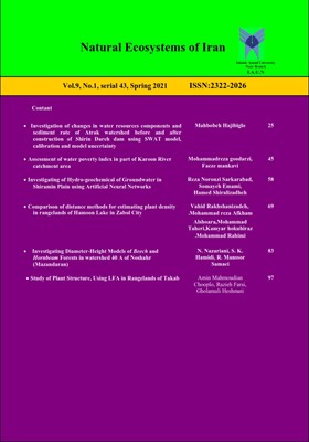
        1 - Study of changes in water resource components and sediment rates of Atrak Watershed before and after the Shirin dareh dam Building Using SWAT, calibration and model uncertainty
        mahboobeh Hajibigloo
        Calibration and analysis of model uncertainty were performed using SUFI-2 program. P-factor, R-factor, br2 and r2 indices were used to evaluate the ability of SWAT model to simulate runoff and sediment before Shirin Dareh dam construction and after Shirin Dareh dam cons More
        Calibration and analysis of model uncertainty were performed using SUFI-2 program. P-factor, R-factor, br2 and r2 indices were used to evaluate the ability of SWAT model to simulate runoff and sediment before Shirin Dareh dam construction and after Shirin Dareh dam construction. The aim of this study is to evaluate the efficiency of SWAT model in estimating average daily flow and sediment concentration and calibration and validation of this model in Atrak watershed located in North Khorasan Razavi province. The results showed that the monthly runoff before shirindare dam building coefficients in calibration P-factor, R-factor, br2 and r2 at the outlet to the 0.73, 1.15, 0.53 and 0.56 and in validation stage 0.77, 1.3, 0.48 and 0.58 respectively. The values for calibration of sediment concentration at the outlet, respectively, 1.58, 2.15, 0.98 0.25, and 0.47 respectively at the stage of validation is 2.5, 0.32 and 0.57. The output produced by the model, Shirin dareh sub-basin to be known as the most erosion. The high annual sediment into the reservoir of the dam and the shelf life is reduced. The results showed that SWAT simulated runoff much better than sediment. The reasons for model poor for simulation of sediment load can be Flow Low simulation, few data, use sediment information Discontinuity can be mentioned. Manuscript profile
      • Open Access Article

        2 - Assessment of water poverty index in part of Karoon River catchment area
        Mohammadreza Goodarzi Faeze mankavi
        The purpose of this study was to investigate water stress in the upper part of the basin of the Karoon River basin for analyzing the water status of the area. After data collection, the amount of water poverty index according to the criteria of resources, access, costs, More
        The purpose of this study was to investigate water stress in the upper part of the basin of the Karoon River basin for analyzing the water status of the area. After data collection, the amount of water poverty index according to the criteria of resources, access, costs, environment and social capacity - economy the was calculated for the upper part of the basin of the Karoon River Basin. After calculating each of the indicators of the Poverty Index, it can be stated that the range of changes in the water poverty index in the studied basin is between 6.6 and 18.2, with the lowest 6.6 points for the environment and the highest score of 18.2 is related to access, the higher the score obtained from each criterion, the better the better the benchmark, which leads to an increase in the value of the poverty indicator and finally indicates that the poverty of the water in that basin is less than Be In general, the water poverty index for the catchment area was 67.65, which is based on the classification of the Oceanographic and Hydrological Center of Wallingford in terms of low water poverty in the range of low to moderate water poverty. According to surveys, the Water Poverty Index can be used as an effective tool in water resource management and a comprehensive water use program to achieve sustainable development goals. Manuscript profile
      • Open Access Article

        3 - Investigating of Hydro-geochemical of Groundwater in Shiramin Plain using Artificial Neural Networks
        Reza Norouzi Somayeh Emami Hamed Shiralizadheh
        Groundwater is one of the most important water resources in arid and semi-arid regions. Increased water consumption due to population growth, has a great impact on quality and quantity of water supply. The main aim of this study was to evaluate the accuracy of interpola More
        Groundwater is one of the most important water resources in arid and semi-arid regions. Increased water consumption due to population growth, has a great impact on quality and quantity of water supply. The main aim of this study was to evaluate the accuracy of interpolation methods for predicting the spatial distribution of some groundwater quality indices for Shiramin plain. In this study, hydro-geochemical quality of groundwater resources for drinking, agricultural and industry purposes was investigated with the Wilcox and Schoeller Standards in Shiramin plain East Azerbaijan province, Iran. Further in the research, the modeling of quality parameters (TDS), EC and SAR is done with using artificial neural network. According to Schuler and Wilcox groundwater quality index, water was moderately suitable and unsuitable for agriculture and drinking, respectively. The most of the samples were in C3-S1 category. The results are representative of the acceptable performance of ANNs to predict groundwater quality. . Manuscript profile
      • Open Access Article

        4 - Comparison of Distance Methods for Plants Density Estimation in Hamoon Lake Rangelands in Zabol
        Vahid Rakhshanizade mohamadreza saeid afkhamoshoara Zeinab Noori Kia mohamad taheri
        Density is one of the most important quantitative indicators in the study of rangelands and therefore it is necessary to choose the most appropriate method for measuring density in each area. Estimating the density of green seedlings in biological projects is also one o More
        Density is one of the most important quantitative indicators in the study of rangelands and therefore it is necessary to choose the most appropriate method for measuring density in each area. Estimating the density of green seedlings in biological projects is also one of the concerns of supervising experts in these projects. Due to the fact that the study area is located in a desert environment have caused the vegetation to be resistant against drought and salinity and their vegetative form is often shrubs. Therefore, this research was done on fast-growing, evergreen, drought and salinity resistant species of Tamarix in three areas of annual planting. All the bases of Tamarix sp were counted in these three areas and in each area, 5 transects of 200 meters were placed parallel to each other and at a distance of 20 meters from each other and 10 points on each were identified as sampling points. This method was considered as a control. With the aim of comparing five distance methods including Closest Individual, Nearest Neighbor, Point-Centered Quarter, Quartered Neighbor and Angle Order in terms of accuracy in estimating the density of green seedlings of Tamarix species to introduce the method that provides the best accuracy in estimating the density of this species. The results show that in the area number one and three the Nearest Neighbor method and in area number two Quartered Neighbor method has the highest accuracy compared to the control. Manuscript profile
      • Open Access Article

        5 - Investigating Diameter-Height Models of Fagus and Carpinus betulus Forest in Area 40 A of Noshahr (Mazandaran)
        Nastaran Nazariani Seyedeh Kosar Hamidi Ramin Mansour Samaei
        Modeling the frequency distribution of variables such as diameter and height of trees as an important factor in the growth and performance of various branches of forest science such as forestry, forestry and biometrics in order to provide sustainable management and prop More
        Modeling the frequency distribution of variables such as diameter and height of trees as an important factor in the growth and performance of various branches of forest science such as forestry, forestry and biometrics in order to provide sustainable management and proper planning of forest resources. Altitude and diameter equations are often used to estimate the height of trees when only the diameter of the trees is measured. In the present study, 12 nonlinear elevation and diameter models were fitted for data of Beech and Hornbeam forests in the Nawshahr (Mazandaran) Area 40 A. The data were divided into two categories. 70% of the data was used for modeling and 30% for validation. In order to select the optimal model, moderate explanation coefficient criteria, mean square error and error were used. The results of different models showed that the Korf model with the coefficients of error, irregularity and mean squared error (R2 = 0.68), (BIAS = 0.52) and (RMSE = 5.82) for modeling and respectively (R2 = 0.68) (BIAS = 0.30) and (RMSE = 5.41) for validation, is a suitable model for the diameter-altitude relationship in the studied area. With regard to aspects of mathematical and biological models studied in this research, korf model as the final model to predict the height of Fagus and Carpinus betulus forests in the area is recommended. Manuscript profile
      • Open Access Article

        6 - Study of Plant Structure, Using LFA in Rangelands of Takab
        amin mahmodian razie farsi golam heshmayi
        The purpose of this study was to investigate the functions of plant structure in semi-arid rangelands of Takab, West Azarbaijan Province, using LFA. To do this, 11 soil surface characteristics were evaluated for assessing soil permeability, nutrient cycle and soil stabi More
        The purpose of this study was to investigate the functions of plant structure in semi-arid rangelands of Takab, West Azarbaijan Province, using LFA. To do this, 11 soil surface characteristics were evaluated for assessing soil permeability, nutrient cycle and soil stability during 20 transects. In this study, a variety of patch and inter patch were detected. During each transect, five replicates of any type of ecological stain and bare soil were taken. Then, the factors measured in the form of three characteristics of stability, permeability and nutrient cycle in each type of structure were classified.The results showed that stability, permeability and nutrient cycling for the patches were respectively wheat bush (59.41, 68.46 and 68.17),Shrub-broadleaf (58.87, 64.33 and 61.49) Shrub (53.28, 31.62, and 60.43) and broadleaf_ grasses (51/16, 51/13 and 59/80). The results showed that the stability, permeability and nutrient cycle when the patch in the region are of the plant type is Bush -grass The condition is far better than other plant patch. The results of this study showed that short shrubs improved the parameters of rangeland performance, including stability, permeability and nutritional cycle. It can also be said that the denser the Bush are, the better soil-forming phenomenon. Manuscript profile