• XML

    isc pubmed crossref medra doaj doaj
  • List of Articles


      • Open Access Article

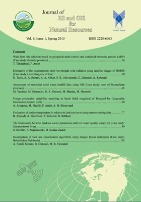
        1 - Wind farm site selection based on geospatial multi-criteria and analytical hierarchy process (AHP) (Case study: Bushehr province)
        Tayebeh Tabatabaei Fazel Amiri
        The aim of this paper is site selection for wind farm based on multi-criteria; climate (wind speed, dominant wind speed and temperature), geography (elevation, slope), socio-economic (distance from roads, distance from cities, distance from the villages), environmental More
        The aim of this paper is site selection for wind farm based on multi-criteria; climate (wind speed, dominant wind speed and temperature), geography (elevation, slope), socio-economic (distance from roads, distance from cities, distance from the villages), environmental (distance from protected areas, landuse, distance from the river), and geological (distance from the earthquake, distance to faults) in a geographic information systems (GIS) using analytical hierarchy process (AHP) in the Bushehr province. According to the role and influence of these criteria, preferences site map is implemented in ArcGIS®10.1 software. Weight of criteria and alternative are determined using AHP in ExpertChoice2000 software. For modeling, spatial analysis and integration layers ArcGIS®10.1 setting was used and the zoning map was obtained at four different classes (very high, high, moderate and low). The results of the site suitability assessment by AHP showed that site NE located at Bushehr province was the most suitable area for locating the wind farm, with covers area of 566218 ha, 24.8% of the total area. Furthermore, the map provides the foundation for decision makers in develop the wind farm location. Finally, the results indicate that GIS as a decision support system, can also prepare the data and the model priorities and expert opinions in relation to various factors in selecting an appropriate location and design is very efficient will help to build power plants. The results indicate that the AHP than other methods of high flexibility in modeling the geospatial data on site selection of wind farm. Manuscript profile
      • Open Access Article

        2 - Estimation of the instantaneous short wavelength solar radiation using satellite images of MODIS (Case study: Central regions of Iran)
        Esmaeil Tazik Abdol Ali Rezaei Ali Abkar Seyed Kazem Alavipanah Zahra Jahantab Alireza Rahmati
        Using renewable energy, particularly solar radiation is considered today as one of the most important energy sources. Therefore the study of solar energy is very important. Although the sun is a great source of energy, but the energy output at ground level does not act More
        Using renewable energy, particularly solar radiation is considered today as one of the most important energy sources. Therefore the study of solar energy is very important. Although the sun is a great source of energy, but the energy output at ground level does not act alike, so that the amount of solar radiation in different parts of the world is changing and it is high in low latitudes. Thus, identifying appropriate locations for implementation of solar energy is necessary. The best and most accurate way to measure this parameter is using devices that measure radiation in stations, but because of natural, economic conditions and other conditions we cannot use them On the other hand, these devices have a limited radius of point measurements. So, in recent years using satellite images these problems have been resolved partially. Therefore, in this study using satellite images of MODIS sensor and narrow band to broadband albedo conversion method, the instantaneous short-wave solar radiation in the central Iranian province of Qom, Isfahan, Tehran and Semnan was estimated. To analyze the results of the coefficient of determination (R2) root mean square error (RMSe) and the mean average error (MAE) was used. Consequently the rate of RMSE was about 42 watts per square meter and MAE rate was about 40.75 watts per square meter indicating the high accuracy of the method used to estimate radiation. Manuscript profile
      • Open Access Article

        3 - Assessment of municipal solid waste landfill sites using GIS (Case study: west of Mazandaran province)
        Mohadese Yazdani Seyed Masoud Monavari Ghasem Ali Omrani Mahmoud Shariat Seyed Mohsen Hosseini
        Several factors to reduce the negative impacts on natural resources as well as public health in landfill sites should be considered. So in the present study the significance lies in the fact that it tends to assess the suitability of the existing municipal landfill site More
        Several factors to reduce the negative impacts on natural resources as well as public health in landfill sites should be considered. So in the present study the significance lies in the fact that it tends to assess the suitability of the existing municipal landfill sites in the west area of Mazandaran province, located in north of Iran, and the south coast of the Caspian Sea. In order to carry out this assessment, 3 guidelines such as United States Environmental Protection Agency, management and planning organization of Iran and Iran department of environment are used. After reviewing all the specified criteria in each of the guidelines with Arc GIS software and visit the field, the authenticity of each deposit site of the study area and the entire area also was examined; and eventually the appropriate areas were identified. As a result, all of the 10 landfill sites were unsuitable with the Iran department of the environment, according to the management and planning organization of Iran only Marzan abad site was suitable and according to USEPA criteria Noor, Noshahr and Kelar abad were suitable and other site were unsuitable. In the entire studied area 20%, according to the Iran department of environment, 48.5%, according to the management and planning organization of Iran and 77.9% of the study area according to the guideline of USEPA were suitable for landfill siting. Manuscript profile
      • Open Access Article

        4 - Forage production suitability modeling in Sarab Sefid rangeland of Borujerd by Geographic Information System (GIS)
        Ali Ariapour Moslem Hadidi Fazel Amiri Ali Hossein Biranvand
        Forage production suitability is one of the most factors to the sustainable utilization of natural potential by rangeland grazing suitability. To determine this factor in short time, low cost and height accuracy is most challenges of expertise and ranchers. Using a suit More
        Forage production suitability is one of the most factors to the sustainable utilization of natural potential by rangeland grazing suitability. To determine this factor in short time, low cost and height accuracy is most challenges of expertise and ranchers. Using a suitable technique for this subject can be sustainable utilization comprising from rangeland ecosystems, according to its degradation and heavy grazing. This research was conducted in Borujerd Sarab Sefid rangeland from 2001 to 2012. Slope, aspect and height maps provided by using satellite imagery, basic information and analog maps and digitized maps such as; topographic and DEM (Digital Elevation Model). Also measurement of field conducted by using clipping and weighting method for estimation of forage, four factors method to range condition, trend balance to range condition trend and physiognomy to typing. Forage production, range condition, ranges condition, trend and typing maps integrated with obtaining and digitized field data in ARCGIS®9.3 software. At least to become changed to final forage production, sustainability this maps in software by using unity command. Result show that from 16 types, 4 types were in non sustainable, 8 types in class III, 2 types in class II and 2 types in class I of sustainability. As a final conclusion this research and other research show that uses RS and GIS can useful for sustainable management of rangeland ecosystems with height accuracy and speed and low cost if considered standards and criteria of using GIS and RS. Manuscript profile
      • Open Access Article

        5 - Evaluation of surface temperature in relation to land use/cover using remote sensing data
        Behrouz Ahmadi Ardavan Ghorbani Taher Safarrad Behrouz Sobhani
        This study aimed to evaluate land surface temperature in relation to vegetation and urban land use using remote sensing data within the city of Ardabil and urban margin of up to 15km radius, using 2010 Landsat TM image, after preprocessing, such as data preparation, rad More
        This study aimed to evaluate land surface temperature in relation to vegetation and urban land use using remote sensing data within the city of Ardabil and urban margin of up to 15km radius, using 2010 Landsat TM image, after preprocessing, such as data preparation, radiometric and geometric correction, which was performed using ENVI®4.7 software. Then for measuring the surface temperature, the thermal band of an image using relevant equations for converting digital numbers to radiance and radiance to brightness temperature was used. In the next step for calculating emissivity the Normalized Difference Vegetation Index (NDVI) index was used and finally land use map in six classes using supervised classification method were extracted from the image. For extracting the vegetation fraction the Dimidiate model was used. To assess the accuracy of surface temperature extracted from the image, hourly data from 4 weather stations was used and to reconcile these data with each other, a simple regression equation was used. Results show that the coefficient of relationship between land surface temperature (derived from the image) and air temperature recorded at the stations was 0.79 and the correlation between recorded air temperature of stations and derived air temperature from the image was obtained 0.99. Manuscript profile
      • Open Access Article

        6 - The relationship between land use vector parameters and river water quality using GIS (Case study: Zayandehrood river)
        Zahra Khebri Farhad Nejadkoorki Hamid Sodaie Zadeh
        The Rivers are more important sources of surface water and fresh water in urban, agricultural and industrial. The aim of this study is to evaluate effects of pollutant sources on the water quality of river Zayandehroud using Geographic information systems (GIS). In this More
        The Rivers are more important sources of surface water and fresh water in urban, agricultural and industrial. The aim of this study is to evaluate effects of pollutant sources on the water quality of river Zayandehroud using Geographic information systems (GIS). In this study, physicochemical data (Discharge, Hardness, Cl, EC, pH), (October 2010 to May 2011) were studied in 7 stations of Zayandehroud. A land use map of the surrounding environment was then investigated with a buffer 0f 10 km from center of the river. Considering the location of monitoring stations the key factors, distance to industrial unit and land use percentage within the station buffet were calculated using GIS. Data moves to SPSS®19 for further statistical analysis. The results show that, at 451682.3 hectares of around buffer the river consisted; 40.9% agricultural and 8.1% urban development. We also found that the physicochemical parameters have a direct with the increase agricultural area around each station relationship. Also located industries in the area of Polkalleh to Chum stations such as south Isfahan refinery, have a significant relationship with water quality factors discussed in this study. So considering the protection importance of the Zayandehroud river, applying appropriate management on this river is essential, especially in the areas after the city. Implementation of appropriate treatment system for industrial wastewater, advised to farmers in the proper use of chemical fertilizers can be the appropriate solution. Manuscript profile
      • Open Access Article

        7 - Investigation of land use classification algorithms using images fusion techniques (Case study: Beheshtabad Sub-basin)
        Arash Fazeli Farsani Reza Ghazavi Mohammad Reza Farzaneh
        In recent decades, land use changes cause an important environmental, economical and social damage in the world. Land use classification images are essential tools for land management and policy decisions.  Fusion of remote sensing data could increase quality and i More
        In recent decades, land use changes cause an important environmental, economical and social damage in the world. Land use classification images are essential tools for land management and policy decisions.  Fusion of remote sensing data could increase quality and intensify of data. The main aim of this study was investigated of land use classification algorithms (Support Vector Machine Background, Neural Net, and Maximum Likelihood) using a fusion of OLI remote sensing data using Geographic Information System (GIS). According to the results, Gram-Schmidt method had the best punctuality for taking of the firstly data and rebuilding of images. The results showed that Maximum likelihood method increased accuracy of PC_Sharpened and Gram-Schmidt algorithms. A significant accuracy in land use classification was observed via combination techniques. Manuscript profile