• XML

    isc pubmed crossref medra doaj doaj
  • List of Articles


      • Open Access Article

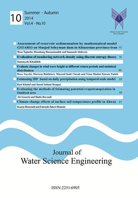
        1 - Assessment of reservoir sedimentation by mathematical model GSTARS3 on Masjed Soleyman dam in Khuzestan Province-Iran
        رضا تاج مهر هوشنگ حسونی زاده سمانه عبدویس
        Accumulation of sediment transport volume and reduce the useful life of dams, water storage tanks can be. So far, many methods for calculating sediment this is presented in reservoirs are generally classified into two categories: mathematical modeling and experimental . More
        Accumulation of sediment transport volume and reduce the useful life of dams, water storage tanks can be. So far, many methods for calculating sediment this is presented in reservoirs are generally classified into two categories: mathematical modeling and experimental .This study examines the effect of using Gstars model parameters in the model, deposition of sediment in the reservoir tank and forecasting of Masjed Soleiman was made. Results indicated that the most sensitive parameter model of deposition and sediment transport equations show that. The model is calibrated using data from the second flood A is less critical than the daily statistics Negligible error rate of 2% between the observed value and the calculation results show that Gstars mathematical model for use in estimating the amount and distribution of precipitation with a suitable model. The annual volume of tank 1/6 was estimated that the observation of the 1/1 percent. Manuscript profile
      • Open Access Article

        2 - Evaluation of monitoring network density using discrete entropy theory
        سمیه خلیفه
        The regional evaluation of monitoring stations for water resources can be of great importance due to its role in finding appropriate locations for stations, the maximum gathering of useful information and preventing the accumulation of unnecessary information and ultima More
        The regional evaluation of monitoring stations for water resources can be of great importance due to its role in finding appropriate locations for stations, the maximum gathering of useful information and preventing the accumulation of unnecessary information and ultimately reducing the cost of data collection. Based on the theory of discrete entropy, this study analyzes the density of rain gage stations in Zohreh Basin located in Fars Province, Iran. Considering the marginal entropy index H(x), joint entropy H(x, y), information send index S(i) and received index R(i) of each station and information transfer index (ITI) between stations, important stations and weak areas of information transfer have been determined in the monitoring network of the basin and spatial interpolation has been calculated. The results showed that the density of the rain gage monitoring network is acceptable. The calculated values for the indexes of R(i) and S(i) are completely parallel and each station receives almost the same amount of data that it sends to other stations. Finally, two new indexes of NH (x) and NH (xˆ(i)) produce equivalent results with R(i) and S(i) indexes. The obtained results showed that 3 stations Noorabad, Baraghan and Ghoshneghan are in the crisis condition and had been and replace it there. also due to the nature of the statistical method, removing of mention station without cheking hydrological conditions and how of hydrograph combination is recommended. Manuscript profile
      • Open Access Article

        3 - Evaluate changes in wind wave height at different return periods and statistical distribution
        رضا نائبی مرتضی بختیاری مسعود صدری نسب نیما شهنی کرم زاده
        Waves are main characteristics of seas that produce by wind. Importance of the study of waves and recognizing the wave climate in the coastal zone management that the waves are the most important influence on the design and implementation of all projects. Wave are main More
        Waves are main characteristics of seas that produce by wind. Importance of the study of waves and recognizing the wave climate in the coastal zone management that the waves are the most important influence on the design and implementation of all projects. Wave are main boundary condition in dynamic loading and structural calculations and hydraulic coastal structures. Height of waves are the most important wave parameters can be affected by various factors change. In present study evaluate changes of this parameters in return periods 2, 5,10,25,50 and 100 years based on statically distribution and bed roughness coefficient. In order to study use mike21 study. The result showed that bed roughness has important significant effects on the reduction or increase of the wave’s height. The analysis was performed according to the return period for the design show that 50 and 100 years. In this return periods have different prior and subsequent periods have been even more. The results also show coefficients of each wave changes substrate design 2-year-old to 200 years old in about 7 to 10 cm. Manuscript profile
      • Open Access Article

        4 - Estimating IDF based on daily precipitation using temporal scale model
        راضی خلف سعید سلطانی
        The intensity –duration –frequency (IDF) curves play most important role in watershed management, flood control and hydraulic design of structures. Conventional method for calculating the IDF curves needs hourly rainfall data in different durations which is More
        The intensity –duration –frequency (IDF) curves play most important role in watershed management, flood control and hydraulic design of structures. Conventional method for calculating the IDF curves needs hourly rainfall data in different durations which is not extensively available in many regions. Instead 24-hour precipitation statistics were measured in most rain-gauge stations. In this study, scaling properties of extreme rainfall are examined to derive scaling IDF curves over different durations. This new method in comparison with traditional method is less computational steps and has lower parameters numbers which causes increasing in reliability of IDF curves. Scaling method was used to extract the IDF curves in Ahwaz rain-gauge station and results proved the efficiency and robustness of the scaling method. The accuracy of scale model method for Determining precipitation intensity, with Duration 30 to 180 minuts in Ahwaz station, is quite acceptable and maximum error is about 11.5%. Manuscript profile
      • Open Access Article

        5 - Evaluating the Methods of Estimating Potential Evapotranspiration in Omidiyeh Town
        علی عصاره حدیث داوودی
        In order to determine the required water for irrigation it is necessary to calculate the amount of needed water by plant or evapotranspiration. The equations that are used to calculate evapotranspiration are not applying the same climatic parameters and, due to their ex More
        In order to determine the required water for irrigation it is necessary to calculate the amount of needed water by plant or evapotranspiration. The equations that are used to calculate evapotranspiration are not applying the same climatic parameters and, due to their experimental nature, they are not suitable for all climatic conditions. In the present study in order to compare evapotranspiration methods and to determine the best method to estimate potential evapotranspiration in Omidiyeh Town, the FAO - Penman - Monteith (FP-M) method was considered as the reference and accuracy of Blaney Criddle (BC), Torrent White (TW) and Hargreaves - Samani (HS) methods that need fewer climatic parameters was compared to it. In addition, statistical data of synoptic station in Omidiyeh were used for the period of 2006 to 2015. The results showed that Blaney - Criddle method, compared to other methods used, with the highest correlation coefficient and the lowest standard error along with FAO Penman-Monteith method were more accurate in estimating potential evapotranspiration in Omidiyeh. Moreover, Blaney Criddle has estimated the average potential evapotranspiration of the town 22% less than the reference method and has the lowest difference to the reference method. Manuscript profile
      • Open Access Article

        6 - Climate change Effects of Surface soil temperature profile in Ahwaz
        کاظم حمادی فاطمه ذاکرحسینی
        In arid and semi-arid regions, soil surface warming is a considerable phenomenon causing a high thermal gradient which makes water flow intensely. The degree of soil temperature is effective on crop production, plant growth and soil microorganisms. In recent years, the More
        In arid and semi-arid regions, soil surface warming is a considerable phenomenon causing a high thermal gradient which makes water flow intensely. The degree of soil temperature is effective on crop production, plant growth and soil microorganisms. In recent years, the ascending trend of temperature has been substantially noticed by researchers in the issues of pointwise climate change and at watershed level. The present study proved the occurrence of ascending trend in time series of temperature through both non-parametric and Mann Kendall parametric tests as well as linear regression in synoptic station in Ahwaz province, Iran. Next, meanwhile the degree of trend was determined, the relations of SoilMedium temperature were obtained for the depths of 5 and 30 cm. Applying the relations of air temperature ascending trend together with the relations of soil-medium temperature both developed a new relation which can express the ascending tend of soil temperature based on medium temperature. These relations indicated that, in depths of 5 and 30 cm, the soil temperature is higher respectively by 2 and 1 ˚C than medium temperature. Furthermore, the ascending trend of temperature gradient of soil surface profile in depths of 5 and 30 cm is respectively 0.038 and 0.030 ˚C per year. Although the increase of soil temperature is assumed to be limited, these low soil temperature changes are effective on plant growth and soil properties like moisture profile of soil structure alteration, thermal conductivity, heat capacity and heat diffusion coefficient. Manuscript profile